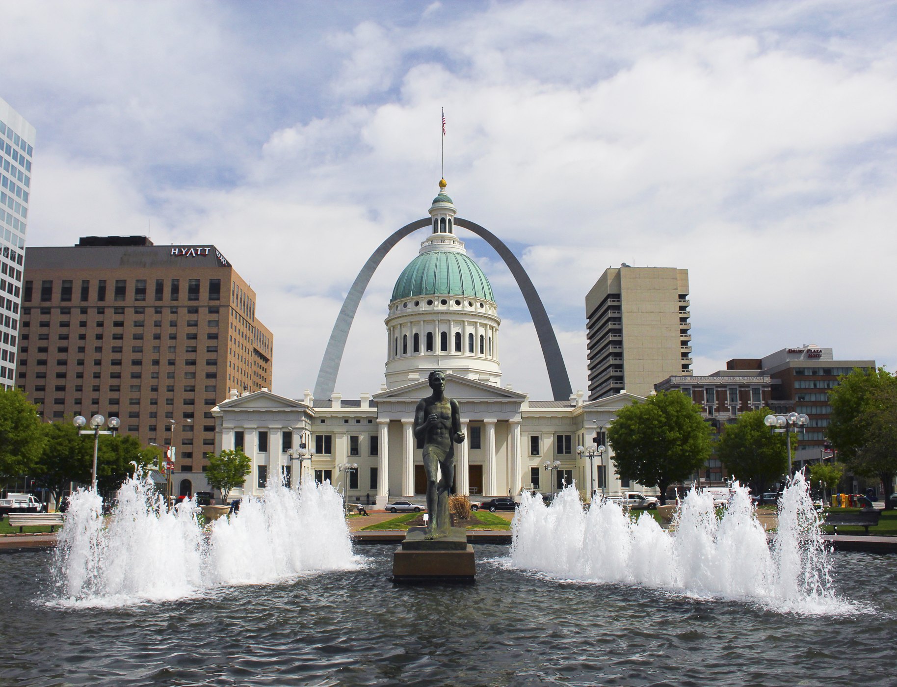
Runner Fountain, the Old Courthouse and Gateway Arch in St. Louis

Outdoors

Fishing near St. Louis

Lakes, rivers and recreation areas near St. Louis where fishing is allowed, closest first.

32places to fish
28 mito the closest
1within 30 miles

Good to know: Anyone 16 or older generally needs a state fishing license; seasons, limits and special rules vary by water. Missouri license information ↗

Closest picks

1

Two Rivers National Wildlife Refuge

28 mi northwest · Fish and Wildlife Service

Two Rivers National Wildlife Refuge was originally established in 1946 as part of the Upper Mississippi River National Wildlife and Fish Refuge to protect and enhance habitat for migratory birds.
2

Mississippi River - Upper

37 mi northwest · US Army Corps of Engineers

Represents the head of navigation for the Corps of Engineers Nine Foot Navigation Project and is located in downtown Minneapolis. The USAF Visitor Center is located at the Upper Lock and is open to the public year around.

3

Dam West Campground

45 mi east · US Army Corps of Engineers

Dam West Campground is a recreation area situated on the southern shore of Carlyle Lake, a prime getaway for city-dwellers and families. Located 50 miles east of St.

Map of all 32 places

Map of 32 places loads as you scroll.

Within 30 miles (1)

28 mi northwest · Fish and Wildlife Service

Two Rivers National Wildlife Refuge

Two Rivers National Wildlife Refuge was originally established in 1946 as part of the Upper Mississippi River National Wildlife and Fish Refuge to protect and enhance habitat for migratory birds.

  • Biking
  • Birding
  • Boating
  • Fishing
  • Hiking
  • Hunting
  • Motor Boat
  • Non-Motorized Boating

30 to 75 miles (17)

37 mi northwest · US Army Corps of Engineers

Mississippi River - Upper

Represents the head of navigation for the Corps of Engineers Nine Foot Navigation Project and is located in downtown Minneapolis. The USAF Visitor Center is located at the Upper Lock and is open to the public year around.

  • Biking
  • Boating
  • Camping
  • Fishing
  • Hiking
  • History
  • Hotel/Lodge/Resort Privately Owned
  • Picnicking

45 mi east · US Army Corps of Engineers · Campground

Dam West Campground

Dam West Campground is a recreation area situated on the southern shore of Carlyle Lake, a prime getaway for city-dwellers and families. Located 50 miles east of St.

  • Accessible Swimming
  • Biking
  • Boating
  • Camping
  • Fishing

45 mi east · US Army Corps of Engineers · Campground

Dam West Day Use

Dam West Day Use Area is situated on the southern shore of Carlyle Lake, a prime getaway for city-dwellers and families. Located 50 miles east of St.

  • Biking
  • Boating
  • Camping
  • Fishing
  • Hiking
  • Hunting
  • Ranger programs
  • Swimming

45 mi east · US Army Corps of Engineers · Campground

Dam West Spillway

Dam West Spillway is situated on the southern shore of Carlyle Lake, a prime getaway for city-dwellers and families. Located 50 miles east of St.

  • Boating
  • Camping
  • Fishing

46 mi east · US Army Corps of Engineers

Carlyle Lake

Water-oriented outdoor recreation opportunities including camping, picnicking, swimming, boating, fishing, and hunting. Expecially attractive to sailboaters. Illinois' largest lake.

  • Boating
  • Camping
  • Fishing
  • Hiking
  • History
  • Hotel/Lodge/Resort Privately Owned
  • Nature education
  • Picnicking

46 mi east · US Army Corps of Engineers · Campground

Dam East Spillway (Day Use)

Dam East Spillway Day Use Area is situated on the southern shore of Carlyle Lake, a prime getaway for city-dwellers and families. Located 50 miles east of St.

  • Biking
  • Boating
  • Camping
  • Fishing
  • History

46 mi south · Fish and Wildlife Service

Middle Mississippi River National Wildlife Refuge

Middle Mississippi River National Wildlife Refuge was established as an individual refuge on May 31, 2000.

  • Archery
  • Biking
  • Birding
  • Boating
  • Fishing
  • Hiking
  • Hunting
  • Motor Boat

47 mi east · US Army Corps of Engineers · Campground

Dam East - McNair Campground

Dam East-McNair Campground is situated on the southern shore of Carlyle Lake, a prime getaway for city-dwellers and families. Located 50 miles east of St.

  • Biking
  • Boating
  • Camping
  • Fishing
  • Hiking
  • Swimming
  • Water sports
  • Wildlife viewing

48 mi east · US Army Corps of Engineers · Campground

Dam East Rec. Area (Day Use)

Dam East Recreation Area is situated on the southern shore of Carlyle Lake, a prime getaway for city-dwellers and families. Located 50 miles east of St.

  • Biking
  • Boating
  • Camping
  • Fishing
  • Picnicking

50 mi east · US Army Corps of Engineers · Campground

Coles Creek Day Use

Coles Creek Day Use Area is situated on the eastern shore of Carlyle Lake, a prime getaway for city-dwellers and families. Located 50 miles east of St.

  • Biking
  • Boating
  • Camping
  • Fishing
  • Hunting
  • Swimming
  • Water sports
  • Wildlife viewing

50 mi east · US Army Corps of Engineers · Campground

Keyesport Rec. Area

Keyesport Recreation Area is situated on the western shore of Carlyle Lake, a prime getaway for city-dwellers and families. Located 50 miles east of St.

  • Boating
  • Camping
  • Fishing
  • Picnicking
  • Swimming

51 mi east · US Army Corps of Engineers · Campground

Coles Creek Campground

Coles Creek Campground is situated on the eastern shore of Carlyle Lake, a prime getaway for city-dwellers and families. Located 50 miles east of St.

  • Biking
  • Boating
  • Camping
  • Fishing
  • Hiking
  • Hunting
  • Ranger programs
  • Swimming

52 mi east · US Army Corps of Engineers · Campground

Boulder Campground

Boulder Campground is situated on the eastern shore of Carlyle Lake, a prime getaway for city-dwellers and families. Located 50 miles east of St.

  • Biking
  • Boating
  • Camping
  • Fishing
  • Hiking
  • Hunting
  • Ranger programs

52 mi east · US Army Corps of Engineers · Campground

Boulder Day Use

Boulder Day Use Area is situated on the eastern shore of Carlyle Lake, a prime getaway for city-dwellers and families. Located 50 miles east of St.

  • Biking
  • Boating
  • Camping
  • Fishing
  • Hiking
  • Hunting
  • Water sports
  • Wildlife viewing

75 mi southwest · USDA Forest Service · Campground

Council Bluff Recreation Area

The Council Bluff Recreation Area is perfect for anyone looking to enjoy the outdoors.

  • Camping
  • Fishing
  • Hunting
  • Swimming
  • Wildlife viewing

75 mi southeast · US Army Corps of Engineers · Campground

North Sandusky Campground

North Sandusky Campground is located on the western shore of Rend Lake near the Sandusky cove— the perfect place to enjoy a wide variety of activities, events, and nature at its best.

  • Biking
  • Birding
  • Boating
  • Camping
  • Fishing
  • Swimming
  • Water Access

75 mi south · USDA Forest Service · Campground

Silver Mines

Silver Mines Campground is located on the St. Francis River in the Mark Twain National Forest. It offers a variety of recreational opportunities and abundant historic and geological wonders.

  • Boating
  • Camping
  • Fishing
  • Hiking
  • Swimming
  • Wildlife viewing

75 miles and farther (14)

86 mi north · Fish and Wildlife Service

Meredosia National Wildlife Refuge

Meredosia National Wildlife Refuge is 3,645 acres and is located in an area that was historically known for its ability to sustain fish and wildlife along the east side of the Illinois River in Morgan and Cass counties, near the town of…

  • Birding
  • Boating
  • Fishing
  • Hiking
  • Nature education
  • Paddling
  • Photography
  • Picnicking

90 mi southeast · Fish and Wildlife Service

Crab Orchard National Wildlife Refuge

Crab Orchard National Wildlife Refuge was established on August 5, 1947. The refuge is made up of 44,000 acres of land with a great diversity of flora and fauna.

  • Backpacking
  • Biking
  • Birding
  • Boating
  • Camping
  • Fishing
  • Hiking
  • Horseback riding

94 mi northeast · US Army Corps of Engineers

Lake Shelbyville

Lake Shelbyville is located in the heart of central Illinois. It offers a wide variety of outdoor activities for people of all ages. Lake Shelbyville consists of 11,100 acres of water and 23,000 acres of land.

  • Boating
  • Camping
  • Fishing
  • Hiking
  • History
  • Horseback riding
  • Hotel/Lodge/Resort Privately Owned
  • Nature education

98 mi southwest · USDA Forest Service

Mark Twain National Forest

  • Backpacking
  • Biking
  • Bird Watching
  • Boating
  • Camping
  • Canoeing
  • Dispersed Camping
  • Fishing

99 mi northwest · US Army Corps of Engineers

Mark Twain Lake

Offers a blend of picturesque natural resources and modern recreation facilities to suit everyone. Three campgrounds boast shaded full hookup and electrical sites.

  • Boating
  • Camping
  • Climbing
  • Fishing
  • Hiking
  • History
  • Horseback riding
  • Hotel/Lodge/Resort Privately Owned

107 mi south · US Army Corps of Engineers

Clearwater Lake

Clearwater Lake is noted for the grandeur of its hills, natural springs, and splendid beauty. Trails and a watchable wildlife area are a sightseer?s delight.

  • Biking
  • Boating
  • Camping
  • Fishing
  • Hiking
  • Picnicking
  • Water sports
  • Wildlife viewing

110 mi southeast · USDA Forest Service

Shawnee National Forest

  • Camping
  • Climbing
  • Fishing
  • Hiking
  • Horseback riding
  • Picnicking
  • Swimming

113 mi southeast · Fish and Wildlife Service

Cypress Creek National Wildlife Refuge

Cypress Creek National Wildlife Refuge was authorized on June 26, 1990 under the Emergency Wetland Resources Act of 1986. The refuge will eventually encompass 35,000 acres.

  • Archery
  • Birding
  • Boating
  • Fishing
  • Hiking
  • Hunting
  • Motor Boat
  • Non-Motorized Boating

115 mi south · Fish and Wildlife Service

Mingo National Wildlife Refuge

The refuge contains 21,592 acres and lies in a basin formed in an ancient abandoned channel of the Mississippi River.

  • Boating
  • Fishing
  • Hiking
  • Hunting
  • Nature education
  • Paddling
  • Photography
  • Ranger programs

117 mi south · US Army Corps of Engineers

Wappapello Lake

Wappapello Lake, MO is a 45,000-acre project nestled in the foothills of the Ozark Mountains on the St. Francis River in Southeast Missouri.

  • Biking
  • Boating
  • Camping
  • Fishing
  • Hiking
  • History
  • Hotel/Lodge/Resort Privately Owned
  • Nature education

118 mi north · Fish and Wildlife Service

Emiquon National Wildlife Refuge

Emiquon National Wildlife Refuge was established in 1993 to restore and protect wetland habitats at the confluence of the Illinois and Spoon Rivers and to help fulfill international obligations contained in various migratory bird treaties…

  • Birding
  • Boating
  • Fishing
  • Hunting
  • Motor Boat
  • Non-Motorized Boating
  • Photography
  • Picnicking

118 mi southwest · National Park Service

Ozark National Scenic Riverways

Ozark National Scenic Riverways is the first national park area to protect a river system. The Current and Jacks Fork rivers are two of the finest floating rivers found anywhere.

  • Camping
  • Fishing
  • Hiking
  • History
  • Horse Camping
  • Hunting
  • Paddling
  • Wildlife viewing

119 mi northwest · Fish and Wildlife Service

Great River National Wildlife Refuge

What is now known as Great River National Wildlife Refuge began in 1958 as part of Mark Twain National Wildlife Refuge, a sprawling refuge which included units along the Mississippi River in Iowa, Missouri and Illinois.

  • Archery
  • Birding
  • Boating
  • Fishing
  • Hiking
  • Hunting
  • Motor Boat
  • Nature education

121 mi north · Fish and Wildlife Service

Chautauqua National Wildlife Refuge

Chautauqua National Wildlife Refuge was established in 1936 for the main purpose of providing sanctuary for the millions of birds that migrate along the Illinois River.

  • Birding
  • Boating
  • Fishing
  • Hiking
  • Hunting
  • Motor Boat
  • Nature education
  • Non-Motorized Boating

Distances are straight-line miles from downtown St. Louis. Listings come from Recreation.gov’s federal recreation database; check each official page for hours, fees, fire restrictions and closures before you go.

Get outside around St. Louis

Top 5 Fun Things to Do in St  Louis, MO! 2025 video thumbnail

THINGS TO DO · YOUTUBE SHORT

Top 5 Fun Things to Do in St Louis, MO! 2025

A local activity Short shared by XploreIn5.

Watch on YouTube ↗
5 Fun Things to do in… St Louis Missouri! video thumbnail

THINGS TO DO · YOUTUBE SHORT

5 Fun Things to do in… St Louis Missouri!

A local activity Short shared by Troy Thomas.

Watch on YouTube ↗

Around St. Louis

Brown Shoe Company Homes-Take Factory on 1201 Russell at 12th in St Louis MO, St. Louis
Brown Shoe Company Homes-Take Factory on 1201 Russell at 12th in St Louis MOParker Botanical · CC BY-SA 3.0
Front and eastern side of the Berry Motor Car Service Building, located at 2220 Washington Street in St, St. Louis
Berry Motor Car Service BuildingNyttend · Public domain
Ashley Street Power Plant (Union Electric Light and Power building), Ashley St, St, St. Louis
Ashley Street Power PlantPaul Sableman · CC BY 2.0

More outdoors near St. Louis

Questions

Where is the closest place for fishing near St. Louis?

Two Rivers National Wildlife Refuge (Fish and Wildlife Service), about 28 miles northwest of St. Louis as the crow flies. Next are Mississippi River - Upper (37 mi) and Dam West Campground (45 mi).

Do I need a fishing license near St. Louis?

Yes, anglers 16 and older generally need a Missouri fishing license from the state wildlife agency. Rules, seasons and limits vary by water.

Who manages these places?

Federal agencies including US Army Corps of Engineers, Fish and Wildlife Service, USDA Forest Service. Each listing links to its official page for hours, fees, closures and current conditions.

St. Louis AI

Your St. Louis local guide
Hey there!

I'm St. Louis AI. Ask about neighborhood food, independent shops, local history or planning a visit.

AI recommendations may be inaccurate. Verify hours and prices. Questions are processed by Cloudflare. Privacy