Illinois State Capitol, Springfield, IL

Get out of town

Day trips from St. Louis

12 nearby parks, towns and places to explore, ordered by straight-line distance.

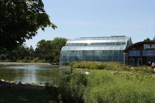
Butterfly House, Missouri Botanical GardenThings to do

Butterfly House, Missouri Botanical Garden

19 miles west · straight-line distanceAbout 25 min by car (22 road miles, typical traffic, checked October 2026)

Zoo in Missouri, Missouri.

Confirm the visitor entrance, hours, reservations, access and seasonal conditions. Islands or water destinations may require different transport.
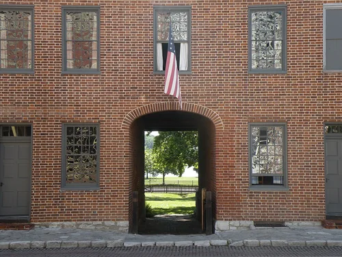
First Missouri State Capitol State Historic SiteState park

First Missouri State Capitol State Historic Site

19 miles northwest · straight-line distance

Historic site in Missouri, United States.

Confirm the visitor entrance, hours, reservations, access and seasonal conditions. Islands or water destinations may require different transport.
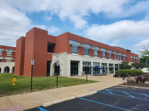
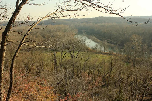
Castlewoodscenic, Castlewood State ParkState park

Castlewood State Park

19 miles west · straight-line distance

State park in Missouri, United States.

Confirm the visitor entrance, hours, reservations, access and seasonal conditions. Islands or water destinations may require different transport.
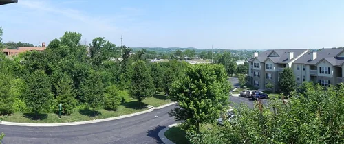
Town

Mascoutah

23 miles southeast · straight-line distanceAbout 30 min by car (28 road miles, typical traffic, checked October 2026)

City in St. Clair County, Illinois, United States.

Confirm the visitor entrance, hours, reservations, access and seasonal conditions. Islands or water destinations may require different transport.
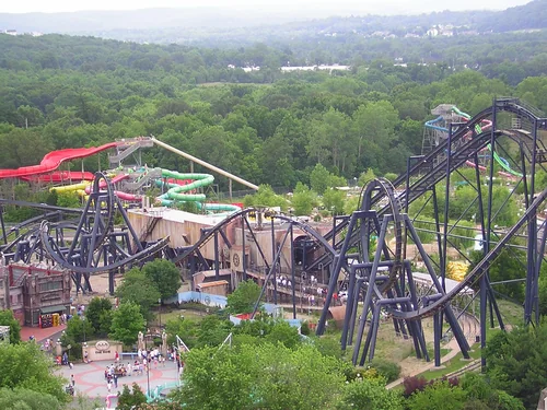
St. Louis Community College, WildwoodTown

Wildwood

25 miles west · straight-line distanceAbout 35 min by car (29 road miles, typical traffic, checked October 2026)

Exurban suburb of St. Louis, located in far western St. Louis County, Missouri, United States.

Confirm the visitor entrance, hours, reservations, access and seasonal conditions. Islands or water destinations may require different transport.
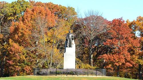
Eureka MissouriTown

Eureka

26 miles west · straight-line distanceAbout 30 min by car (29 road miles, typical traffic, checked October 2026)

City located in St. Louis County, Missouri, United States.

Confirm the visitor entrance, hours, reservations, access and seasonal conditions. Islands or water destinations may require different transport.
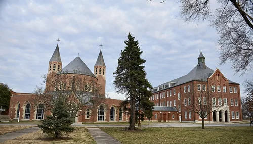
Batman - The Ride - St. Louis, Mid America AdventureThings to do

Mid America Adventure

27 miles west · straight-line distanceAbout 35 min by car (32 road miles, typical traffic, checked October 2026)

Amusement park operated by Enchanted Parks.

Confirm the visitor entrance, hours, reservations, access and seasonal conditions. Islands or water destinations may require different transport.
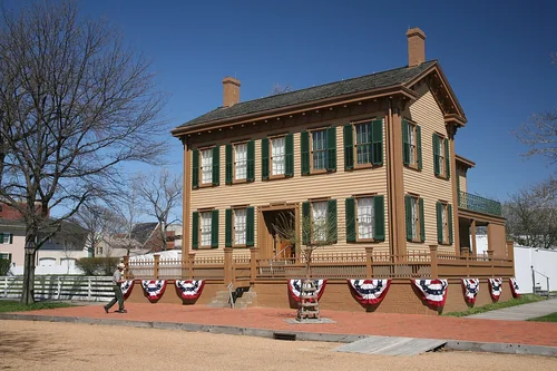
Babler Memorial - 20131102-114, Babler State ParkState park

Babler State Park

27 miles west · straight-line distance

State park in Wildwood, Missouri.

Confirm the visitor entrance, hours, reservations, access and seasonal conditions. Islands or water destinations may require different transport.
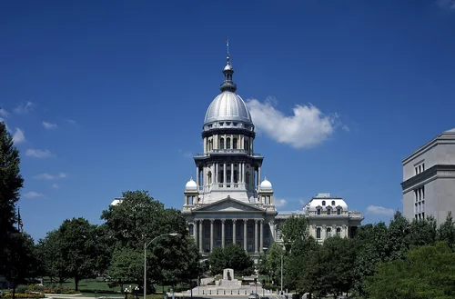
The St. Mary's Institute of O'FallonTown

O'Fallon

30 miles west · straight-line distanceAbout 40 min by car (36 road miles, typical traffic, checked October 2026)

City in St. Charles County, Missouri, United States.

Confirm the visitor entrance, hours, reservations, access and seasonal conditions. Islands or water destinations may require different transport.

Lincoln Home National Historic SiteNational park site

Lincoln Home National Historic Site

86 miles north · straight-line distance

National historic site in Illinois, USA.

HistoryWildlife viewingAgency site ↗

Confirm the visitor entrance, hours, reservations, access and seasonal conditions. Islands or water destinations may require different transport.

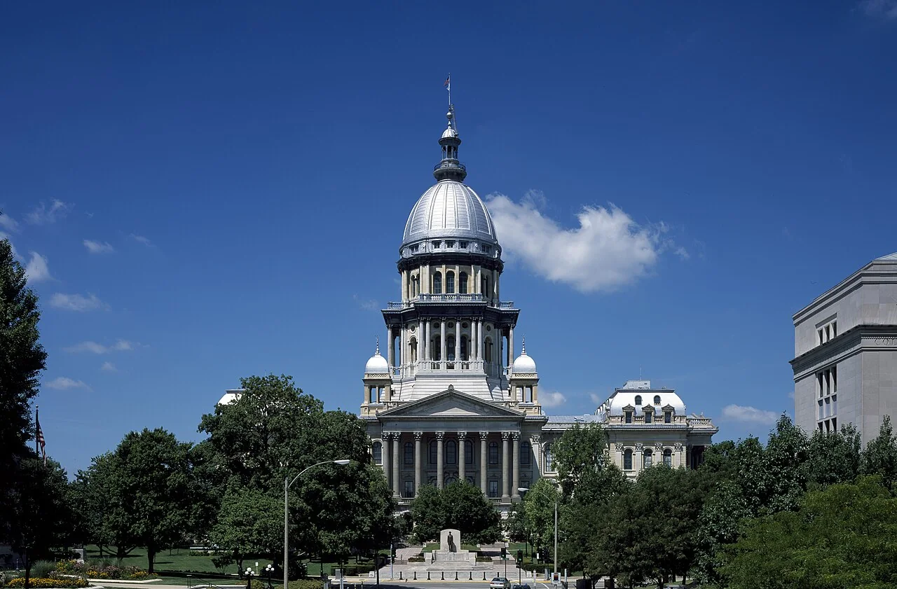
Illinois State Capitol, Springfield, ILTown

Springfield

86 miles north · straight-line distanceAbout 1 hr 30 min by car (97 road miles, typical traffic, checked October 2026)

Capital city of the U.S. state of Illinois and county seat of Sangamon County.

Confirm the visitor entrance, hours, reservations, access and seasonal conditions. Islands or water destinations may require different transport.

Things to do

Lincoln's New Salem

95 miles north · straight-line distanceAbout 1 hr 55 min by car (118 road miles, typical traffic, checked October 2026)

Recreated former frontier village in Menard County, Illinois.

Confirm the visitor entrance, hours, reservations, access and seasonal conditions. Islands or water destinations may require different transport.

Driving times are typical estimates from the city center without live traffic, Powered by Geoapify · © OpenStreetMap contributors.

Distances are measured in a straight line from the city, not by road. Some older drive-time estimates have no reliable date and do not reflect current traffic; routes to large parks or waterfronts may vary. Check the destination entrance before leaving. Place descriptions come from Wikidata. Photo credits include capture dates when available; photos may not show current conditions.

Outdoor places near St. Louis

40 recreation areas and campgrounds within 121 miles, from Recreation.gov. Filter by what you want to do.

Recreation area

Ulysses S Grant National Historic Site

10 miles southwest · straight-line distanceNational Park Service

Ulysses S. Grant is known as the victorious Civil War general who saved the Union and the 18th President of the United States. He first met Julia Dent, his future wife, at her family home, named White Haven.

History

Recreation area

Two Rivers National Wildlife Refuge

28 miles northwest · straight-line distanceFish and Wildlife Service

Two Rivers National Wildlife Refuge was originally established in 1946 as part of the Upper Mississippi River National Wildlife and Fish Refuge to protect and enhance habitat for migratory birds.

BikingBirdingBoatingFishingHikingHuntingMotor BoatNon-Motorized Boating

Recreation area

Mississippi River - Upper

37 miles northwest · straight-line distanceUS Army Corps of Engineers

Represents the head of navigation for the Corps of Engineers Nine Foot Navigation Project and is located in downtown Minneapolis. The USAF Visitor Center is located at the Upper Lock and is open to the public year around.

BikingBoatingCampingFishingHikingHistoryHotel/Lodge/Resort Privately OwnedPicnicking

Campground

Dam West Campground

45 miles east · straight-line distanceAbout 55 min by car (50 road miles, checked October 2026)US Army Corps of Engineers

Dam West Campground is a recreation area situated on the southern shore of Carlyle Lake, a prime getaway for city-dwellers and families. Located 50 miles east of St.

Accessible SwimmingBikingBoatingCampingFishing

Campground

Dam West Day Use

45 miles east · straight-line distanceAbout 55 min by car (49 road miles, checked October 2026)US Army Corps of Engineers

Dam West Day Use Area is situated on the southern shore of Carlyle Lake, a prime getaway for city-dwellers and families. Located 50 miles east of St.

BikingBoatingCampingFishingHikingHuntingRanger programsSwimming

Campground

Dam West Spillway

45 miles east · straight-line distanceAbout 55 min by car (50 road miles, checked October 2026)US Army Corps of Engineers

Dam West Spillway is situated on the southern shore of Carlyle Lake, a prime getaway for city-dwellers and families. Located 50 miles east of St.

BoatingCampingFishing

Recreation area

Carlyle Lake

46 miles east · straight-line distanceUS Army Corps of Engineers

Water-oriented outdoor recreation opportunities including camping, picnicking, swimming, boating, fishing, and hunting. Expecially attractive to sailboaters. Illinois' largest lake.

BoatingCampingFishingHikingHistoryHotel/Lodge/Resort Privately OwnedNature educationPicnicking

Campground

Dam East Spillway (Day Use)

46 miles east · straight-line distanceAbout 1 hr 15 min by car (52 road miles, checked October 2026)US Army Corps of Engineers

Dam East Spillway Day Use Area is situated on the southern shore of Carlyle Lake, a prime getaway for city-dwellers and families. Located 50 miles east of St.

BikingBoatingCampingFishingHistory

Recreation area

Middle Mississippi River National Wildlife Refuge

46 miles south · straight-line distanceFish and Wildlife Service

Middle Mississippi River National Wildlife Refuge was established as an individual refuge on May 31, 2000.

ArcheryBikingBirdingBoatingFishingHikingHuntingMotor Boat

Campground

Dam East - McNair Campground

47 miles east · straight-line distanceAbout 1 hr by car (52 road miles, checked October 2026)US Army Corps of Engineers

Dam East-McNair Campground is situated on the southern shore of Carlyle Lake, a prime getaway for city-dwellers and families. Located 50 miles east of St.

BikingBoatingCampingFishingHikingSwimmingWater sportsWildlife viewing

Recreation area

Mississippi River - Kaskaskia River

47 miles south · straight-line distanceUS Army Corps of Engineers

The Rivers Project is responsible for the operation and maintenance of five dams and seven locks, 300 miles of dikes and revetment and 110,000 acres of public lands and waters for the authorized purpose of maintaining a nine-foot…

BoatingCampingHistoryPicnickingWater sportsWildlife viewing

Campground

Dam East Rec. Area (Day Use)

48 miles east · straight-line distanceAbout 1 hr by car (53 road miles, checked October 2026)US Army Corps of Engineers

Dam East Recreation Area is situated on the southern shore of Carlyle Lake, a prime getaway for city-dwellers and families. Located 50 miles east of St.

BikingBoatingCampingFishingPicnicking

Campground

Coles Creek Day Use

50 miles east · straight-line distanceAbout 1 hr 15 min by car (62 road miles, checked October 2026)US Army Corps of Engineers

Coles Creek Day Use Area is situated on the eastern shore of Carlyle Lake, a prime getaway for city-dwellers and families. Located 50 miles east of St.

BikingBoatingCampingFishingHuntingSwimmingWater sportsWildlife viewing

Campground

Keyesport Rec. Area

50 miles east · straight-line distanceAbout 1 hr 10 min by car (58 road miles, checked October 2026)US Army Corps of Engineers

Keyesport Recreation Area is situated on the western shore of Carlyle Lake, a prime getaway for city-dwellers and families. Located 50 miles east of St.

BoatingCampingFishingPicnickingSwimming

Campground

Coles Creek Campground

51 miles east · straight-line distanceAbout 1 hr 15 min by car (61 road miles, checked October 2026)US Army Corps of Engineers

Coles Creek Campground is situated on the eastern shore of Carlyle Lake, a prime getaway for city-dwellers and families. Located 50 miles east of St.

BikingBoatingCampingFishingHikingHuntingRanger programsSwimming

Campground

Lotus Group Area

51 miles east · straight-line distanceAbout 1 hr 15 min by car (62 road miles, checked October 2026)US Army Corps of Engineers

The Lotus Group Area is on the eastern shore of Carlyle Lake, a prime getaway for city-dwellers and families. Located 50 miles east of St.

BoatingCampingHuntingRanger programsWildlife viewing

Campground

Boulder Campground

52 miles east · straight-line distanceAbout 1 hr 15 min by car (63 road miles, checked October 2026)US Army Corps of Engineers

Boulder Campground is situated on the eastern shore of Carlyle Lake, a prime getaway for city-dwellers and families. Located 50 miles east of St.

BikingBoatingCampingFishingHikingHuntingRanger programs

Campground

Boulder Day Use

52 miles east · straight-line distanceAbout 1 hr 15 min by car (63 road miles, checked October 2026)US Army Corps of Engineers

Boulder Day Use Area is situated on the eastern shore of Carlyle Lake, a prime getaway for city-dwellers and families. Located 50 miles east of St.

BikingBoatingCampingFishingHikingHuntingWater sportsWildlife viewing

Recreation area

Clarence Cannon National Wildlife Refuge

55 miles northwest · straight-line distanceFish and Wildlife Service

Clarence Cannon National Wildlife Refuge was established in 1964 with funds from the purchase of migratory waterfowl stamps. It lies in Pike County, Missouri, Pool 25 about one mile east of the small town of Annada, Missouri.

BackpackingBirdingBoatingHikingHuntingNature educationPaddlingPhotography

Campground

Council Bluff Recreation Area

75 miles southwest · straight-line distanceUSDA Forest Service

The Council Bluff Recreation Area is perfect for anyone looking to enjoy the outdoors.

CampingFishingHuntingSwimmingWildlife viewing

Campground

North Sandusky Campground

75 miles southeast · straight-line distanceAbout 1 hr 35 min by car (99 road miles, checked October 2026)US Army Corps of Engineers

North Sandusky Campground is located on the western shore of Rend Lake near the Sandusky cove— the perfect place to enjoy a wide variety of activities, events, and nature at its best.

BikingBirdingBoatingCampingFishingSwimmingWater Access

Campground

Silver Mines

75 miles south · straight-line distanceAbout 1 hr 35 min by car (94 road miles, checked October 2026)USDA Forest Service

Silver Mines Campground is located on the St. Francis River in the Mark Twain National Forest. It offers a variety of recreational opportunities and abundant historic and geological wonders.

BoatingCampingFishingHikingSwimmingWildlife viewing

Campground

South Sandusky Day Use

76 miles southeast · straight-line distanceAbout 1 hr 40 min by car (101 road miles, checked October 2026)US Army Corps of Engineers

South Sandusky Day Use Area— the perfect place to enjoy a wide variety of activities, events, and nature at its best. Rend Lake is made up of 20,633 acres of water and 19,523 acres of land.

BikingBirdingBoatingCampingCanoeingKayakingRanger programsSwimming

Recreation area

Rend Lake

78 miles southeast · straight-line distanceUS Army Corps of Engineers

Rend Lake, IL, located in the heart of southern Illinois, is a natural haven for wildlife and a recreational haven for visitors. Rend Lake consists of 18,900 acres of water and 20,000 acres of land.

BoatingCampingHikingHorseback ridingHotel/Lodge/Resort Privately OwnedNature educationPicnickingWater sports

Recreation area

Lincoln Home National Historic Site

86 miles north · straight-line distanceNational Park Service

Abraham Lincoln believed in the ideal that everyone in America should have the opportunity to improve their economic and social condition. Lincoln’s life was the embodiment of that idea.

HistoryWildlife viewing

Recreation area

Meredosia National Wildlife Refuge

86 miles north · straight-line distanceFish and Wildlife Service

Meredosia National Wildlife Refuge is 3,645 acres and is located in an area that was historically known for its ability to sustain fish and wildlife along the east side of the Illinois River in Morgan and Cass counties, near the town of…

BirdingBoatingFishingHikingNature educationPaddlingPhotographyPicnicking

Recreation area

Crab Orchard National Wildlife Refuge

90 miles southeast · straight-line distanceFish and Wildlife Service

Crab Orchard National Wildlife Refuge was established on August 5, 1947. The refuge is made up of 44,000 acres of land with a great diversity of flora and fauna.

BackpackingBikingBirdingBoatingCampingFishingHikingHorseback riding

Recreation area

Illinois River - Riverlands

92 miles north · straight-line distanceUS Army Corps of Engineers

The Rivers Project is responsible for the operation and maintenance of five dams and seven locks, 300 miles of dikes and revetment and 110,000 acres of public lands and waters for the authorized purpose of maintaining a nine-foot…

BoatingHikingHistoryWater sportsWildlife viewing

Recreation area

Lake Shelbyville

94 miles northeast · straight-line distanceUS Army Corps of Engineers

Lake Shelbyville is located in the heart of central Illinois. It offers a wide variety of outdoor activities for people of all ages. Lake Shelbyville consists of 11,100 acres of water and 23,000 acres of land.

BoatingCampingFishingHikingHistoryHorseback ridingHotel/Lodge/Resort Privately OwnedNature education

Recreation area

Mark Twain National Forest

98 miles southwest · straight-line distanceUSDA Forest Service

BackpackingBikingBird WatchingBoatingCampingCanoeingDispersed CampingFishing

Recreation area

Mark Twain Lake

99 miles northwest · straight-line distanceUS Army Corps of Engineers

Offers a blend of picturesque natural resources and modern recreation facilities to suit everyone. Three campgrounds boast shaded full hookup and electrical sites.

BoatingCampingClimbingFishingHikingHistoryHorseback ridingHotel/Lodge/Resort Privately Owned

Recreation area

Clearwater Lake

107 miles south · straight-line distanceUS Army Corps of Engineers

Clearwater Lake is noted for the grandeur of its hills, natural springs, and splendid beauty. Trails and a watchable wildlife area are a sightseer?s delight.

BikingBoatingCampingFishingHikingPicnickingWater sportsWildlife viewing

Recreation area

Shawnee National Forest

110 miles southeast · straight-line distanceUSDA Forest Service

CampingClimbingFishingHikingHorseback ridingPicnickingSwimming

Recreation area

Cypress Creek National Wildlife Refuge

113 miles southeast · straight-line distanceFish and Wildlife Service

Cypress Creek National Wildlife Refuge was authorized on June 26, 1990 under the Emergency Wetland Resources Act of 1986. The refuge will eventually encompass 35,000 acres.

ArcheryBirdingBoatingFishingHikingHuntingMotor BoatNon-Motorized Boating

Recreation area

Mingo National Wildlife Refuge

115 miles south · straight-line distanceFish and Wildlife Service

The refuge contains 21,592 acres and lies in a basin formed in an ancient abandoned channel of the Mississippi River.

BoatingFishingHikingHuntingNature educationPaddlingPhotographyRanger programs

Recreation area

Wappapello Lake

117 miles south · straight-line distanceUS Army Corps of Engineers

Wappapello Lake, MO is a 45,000-acre project nestled in the foothills of the Ozark Mountains on the St. Francis River in Southeast Missouri.

BikingBoatingCampingFishingHikingHistoryHotel/Lodge/Resort Privately OwnedNature education

Recreation area

Emiquon National Wildlife Refuge

118 miles north · straight-line distanceFish and Wildlife Service

Emiquon National Wildlife Refuge was established in 1993 to restore and protect wetland habitats at the confluence of the Illinois and Spoon Rivers and to help fulfill international obligations contained in various migratory bird treaties…

BirdingBoatingFishingHuntingMotor BoatNon-Motorized BoatingPhotographyPicnicking

Recreation area

Ozark National Scenic Riverways

118 miles southwest · straight-line distanceNational Park Service

Ozark National Scenic Riverways is the first national park area to protect a river system. The Current and Jacks Fork rivers are two of the finest floating rivers found anywhere.

CampingFishingHikingHistoryHorse CampingHuntingPaddlingWildlife viewing

Recreation area

Great River National Wildlife Refuge

119 miles northwest · straight-line distanceFish and Wildlife Service

What is now known as Great River National Wildlife Refuge began in 1958 as part of Mark Twain National Wildlife Refuge, a sprawling refuge which included units along the Mississippi River in Iowa, Missouri and Illinois.

ArcheryBirdingBoatingFishingHikingHuntingMotor BoatNature education

Recreation area

Chautauqua National Wildlife Refuge

121 miles north · straight-line distanceFish and Wildlife Service

Chautauqua National Wildlife Refuge was established in 1936 for the main purpose of providing sanctuary for the millions of birds that migrate along the Illinois River.

BirdingBoatingFishingHikingHuntingMotor BoatNature educationNon-Motorized Boating

Recreation areas and campgrounds from Recreation.gov's directory, checked October 9, 2026. Listings are not live availability: check Recreation.gov or the managing agency for open dates, fees, reservations and conditions. Directions go to the listed coordinates, which may not be the entrance. Campground driving times: Powered by Geoapify · © OpenStreetMap contributors.

Questions

What day-trip ideas are near St. Louis?

This guide includes Butterfly House, Missouri Botanical Garden, First Missouri State Capitol State Historic Site, Castlewood State Park, Mascoutah, Wildwood. Places are ordered by straight-line distance. Confirm visitor access, opening hours and current travel conditions before choosing a trip.

How far is Butterfly House, Missouri Botanical Garden from St. Louis?

Approximately 19 miles west in a straight line; driving takes about 25 min over 22 road miles in typical traffic (Geoapify, checked October 2026). This is not current traffic or a route to a confirmed visitor entrance. Check your route before leaving.

How far is First Missouri State Capitol State Historic Site from St. Louis?

Approximately 19 miles northwest in a straight line. This is not current traffic or a route to a confirmed visitor entrance. Check your route before leaving.

How far is Castlewood State Park from St. Louis?

Approximately 19 miles west in a straight line. This is not current traffic or a route to a confirmed visitor entrance. Check your route before leaving.

Where can I camp near St. Louis?

Recreation.gov lists 16 campgrounds within 76 miles, including Dam West Campground (45 miles east), Dam West Day Use (45 miles east), Dam West Spillway (45 miles east). Check Recreation.gov for current availability, seasons and reservations.

St. Louis AI

Your St. Louis local guide
Hey there!

I'm St. Louis AI. Ask about neighborhood food, independent shops, local history or planning a visit.

AI recommendations may be inaccurate. Verify hours and prices. Questions are processed by Cloudflare. Privacy